This is what UNESCO say about these tombs:
The zone encompassing the settlement and necropolis of Bat is the most complete and best-known site of the 3rd millennium BC. In a restricted, coherent space, the necropolis of Bat bears characteristic and unique witness to the evolution of funeral practices during the first Bronze Age in the Oman peninsula.
Historical sources recount that the country of Magan was the principal extraction centre for copper, which was exported even to far-away Mesopotamia, as early as about 3000 BC. The appearance of a more strictly hierarchical social organization (as attested to both in the settlements, where circular defensive structures contrast with rectangular houses, and in the necropolis, where the arrangement of funerary space is more complex) goes hand in hand with higher living standards and social changes linked to a trade economy.
The protohistoric site extends north of the village and palm grove of Bat, when excavation began in 1972; it includes a settlement and a necropolis from the 3rd millennium BC. In the settlement zone, north of the confluence of a small waterway and Wadi al Hijr, there are five stone ‘towers’, structures that are very representative of the first Bronze Age in the Oman peninsula. One of the towers has been entirely excavated and it has been determined that it was built between 2595 BC and 2465 BC. At the level of the substructures, the plan of the tower features a series of exterior surface projections and two rows of parallel rooms on either side of a large platform in masonry with a well in the centre.
From the tower, which serves as the site’s reference point, can be distinguished immediately to the east on the slope a series of rectangular houses with central courts and, to the north, a vast necropolis that can be divided into two distinct groups. The first group is located at the top of the rocky slope. Its drystone tombs (some of which date from the 4th millennium, although in some cases they may have subsequently been modified) are scattered along the path from Bat to Al Wahrah.
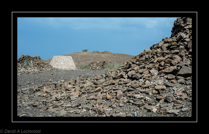
The much more densely concentrated second group extends over rice terraces south-east of the wadi and includes more than 100 drystone ‘beehive’ tombs, which tend to be organized according to an overall plan. The most ancient ones are to the north. They have only one entrance and one funerary chamber and were a collective burial-place for a small number of dead. Towards the south, the sepulchres become more monumental. They have two entrances which open on to two and sometimes four funerary chambers and were intended for larger numbers of dead.
The settlement and necropolis zones of Bat form a coherent and representative group with two neighbouring contemporary archaeological sites: the tower of Al-Khutm, 2 km west of Bat, and the group of beehive tombs of Qubur Juhhal at Al-Ayn, 22 km east-south-east of Bat. The 21 tombs from the 3rd millennium, aligned on a rocky crest that stands out in the superb mountainous landscape of Jebel Misht to the north, are in a remarkable state of preservation. They have not been excavated and constitute an obviously interesting archaeological reserve.
The site can be found near Ibri (عبري) a city in the region Az Zahirah, northwest Oman.

 C41 negatives scanned with a Plustek 7600i and cleaned up in P/S Cs6 (they needed it !) The local shop did not take as much care as one would expect in more modern places. The negatives had faded (old chemicals used probably) and the colour had shifted a bit.