Merry Christmas and a Happy New Year.
Category: Information.
JJC ES-2 Film Digitizing Adapter (clone of Nikon ES-2).
 This is a digitised Ilford HP5 Plus negative.
I have been doing tests with a newly acquired JJC ES-2 clone of the Nikon ES-2 film digitiser.

. Click above image for Amazon link.
It works very well and comes with a LED light attachment which the Nikon version does not have.
The setup I used was:
Nikon D800, PK11(a), PK13, Nikkor 55mm F2.8 AIs micro and the slide/film copier.
It is a lot cheaper than the Nikon equivalent (seems made of engineering plastic like the Nikon one) and includes the LED light attachment along with 5 lens adapters.
Found a sheet of negatives from the 1980s.
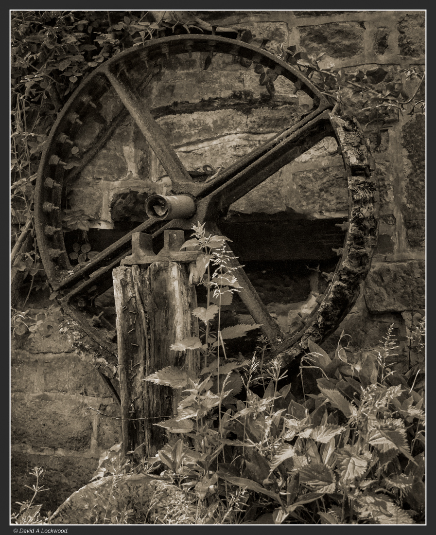
Water Mill drive converter wheel.
Going through old negatives, I found a sheet from the early 1980s of Padley Mill and Padley woods in the Peak District National Park: Derbyshire.
Kodacolor VR200 film which was made between 1982 to 86, this helped me date them at more than 35 years old.
I have been scanning and converting some into B&W.
York Minster.

I am almost sure this negative (T-max TMY not TMY-2) was made in the early 1980’s.
The first recorded church on this site was a wooden structure built in 627, the present building was begun in about 1230 and completed in 1472. Looking at its history: the site seems to have been beset by fires ! see this Wiki link.
Dhofar coast & Dame Freya Stark.
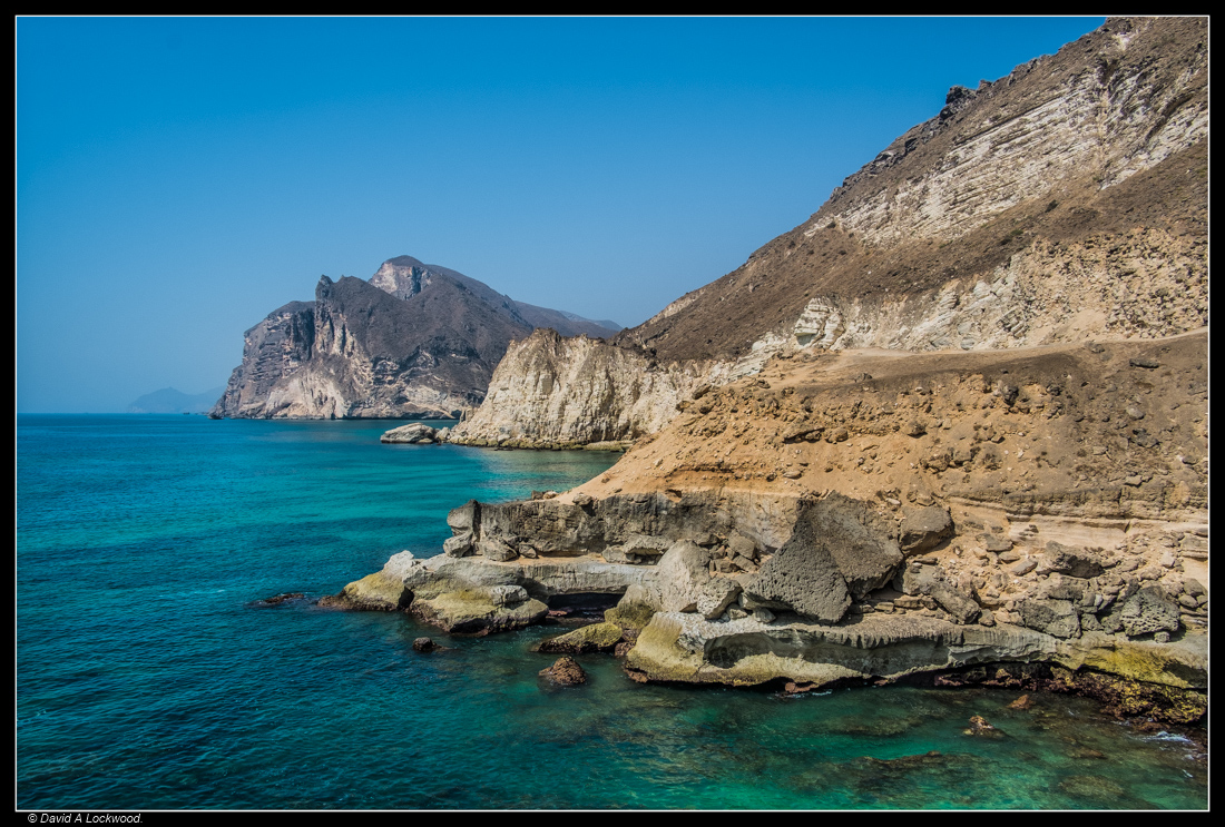 From my Oman files.
Dhofar coast: the type of coastline Freya Stark would have seen and described in the book I am now reading, also the one from my previous post – see below..
From the big encyclopædia in the sky:
Dame Freya Madeline Stark. DBE.
In 1934, Stark sailed down the Red Sea to Aden and began a new adventure. She hoped to trace the frankincense route of the Hadhramaut, the hinterland of southern Arabia. Only a handful of Western explorers had ventured into the region but never as far or as widely as she. Her goal was to reach the ancient city of Shabwa, which was rumoured to have been the capital of the Queen of Sheba.
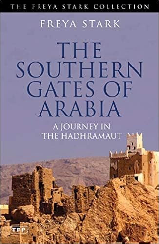 Click cover for Amazon link and note how rare and expensive most of her hardback books have become. Ex-library or well used books can be got at reasonable cost: many of her First addition, Mint & Fine used copies are not easily found.
Punishment stocks – City of York.
 Nikon F4 / Nikkor 50mm f1.8 D with Nikon diffusion filter on T-Max 400 (original*)
from my freezer.
The stocks were used as a punishment for crimes of public disorder (drunkenness for example) throughout the 16th and 17th centuries. Their use declined in the 18th century, but probably last used in the UK at the market town of Newcastle Emlyn west Wales in 1872.
The criminal being locked in by legs & hands or hands & head: they were then subjected to ridicule by the local population who threw rotting fruit and in some cases stones at them.
* 1987: so this film is over 30 years old.
On the subject of trees and Ents.
 An Embrace.
From my Oman files.
Unfortunately these two trees no longer live, cut down during a redevelopment of the housing complex where I lived when in Oman.
For those who have no idea what an Ent is – see this link from the great encyclopædia in the sky: Ents
Yesterdays book connection.
Clive Staples Lewis: 29 November 1898 – 22 November 1963. C S Lewis began his academic career as an undergraduate student at Oxford University, earning a triple first.
Elected a Fellow of Magdalen College, Oxford, where he worked from 1925 to 1954. Then In 1954, he was awarded the newly founded chair of Mediaeval and Renaissance Literature at Cambridge University
The Chronicles of Narnia, a series of seven novels that are considered a classic of children’s literature. Written between 1949 and 1954.
Like J.R.R Tolkien ‘The Hobbit’ and Arthur Ransome ‘Swallows and Amazons series’ which also maybe considered children’s books, they have become firm favourites for very many adults as well.
 Click image for Amazon link.
The connection between Great Malvern gas lamps and this series of books, was a story that C.S Lewis is said to have been inspired by them for his opening description of Narnia in The Lion, The Witch and The Wardrobe. Walking home from a Malvern pub one snowy night with his friends J.R.R Tolkien and George Sayer; while looking at the gas lamps, was said to have remarked how such imagery would be well suited in a future book, true? I’m not sure, but it’s a nice story.
All three authors spent many happy hours walking in the Malvern hills, so maybe there was inspiration for many of the books.
Also, did anyone realise why I titled the image posted before the gas lamp ‘I spy with my little eye’ it was because, on a pole middle right of the photograph is a surveillance camera.
St William’s College – York.
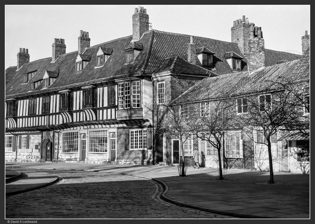 My files of the late 1970’s: from an Ilford FP4 negative.
St William’s College, a Mediaeval building in York which was originally built to provide accommodation for priests attached to chantry chapels at nearby York Minster.
The college was founded in c.1465 by George Neville and the Earl of Warwick to house twenty-three priests and a provost. While the college was not a monastic establishment, it was affected by the Dissolution of the Monasteries and the college then passed into secular ownership.
The building was bought by the Province of York in 1912 for use by its convocation.
See this link for a full history of the building: York Civic trust St William’s college.
Part of Rievaulx Abbey ?
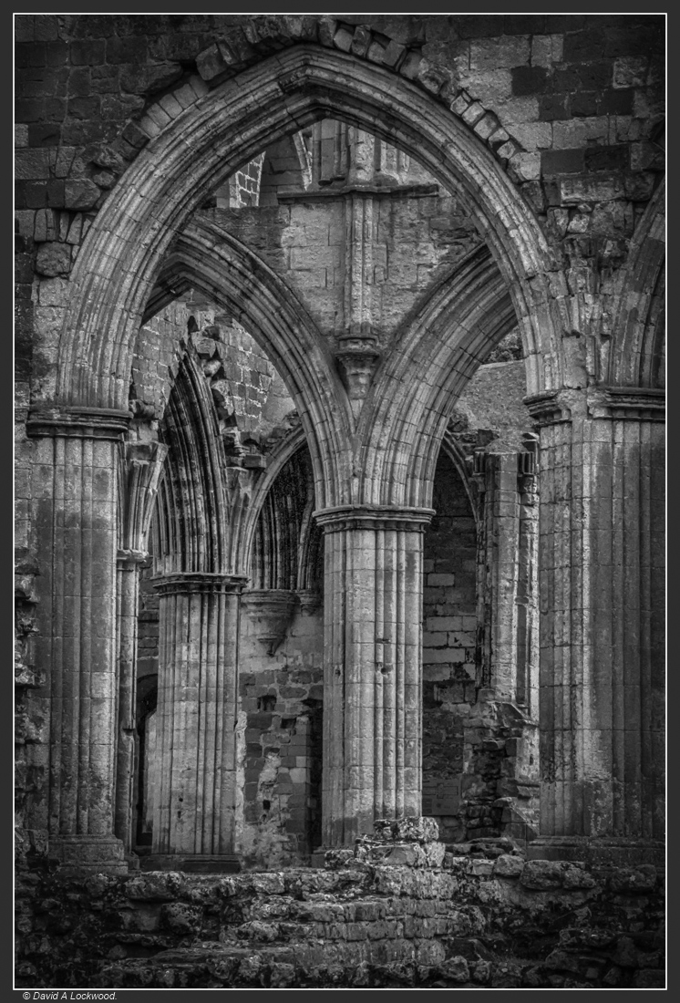 Another old negative: this one from 1987 or 88. I am reasonably sure it’s Rievaulx Abbey
North Yorkshire.
The file sheet said: Abbey – Nikon F4 with Tokina 35-70 f2.8 AIs AT-X / T-max 400. There are 22 negatives in the file sheet and all of the same place.
I remember visiting Rievaulx Abbey in the mid 1980’s and as T-max came on the market in 1986, these were probably made late 87 or 88. That’s the problem going through old negatives, I was not so careful making notes as I assumed I would remember.
Up date: found the receipt for my Nikon F4, so this dates these to no earlier than 1988.
Rievaulx Abbey was a Cistercian monastery, founded in 1131 by Walter Espec in a secluded valley on the edge of the North York Moors.
The first structures at Rievaulx were temporary timber buildings, intended to serve only until proper permanent buildings could be erected in stone. The first stone structures were begun under the first abbot, William (1132-1145), sometime after 1135.
From these modest beginnings grew one of the wealthiest monasteries of medieval England and the first northern Cistercian monastery. Rievaulx enjoyed the protection of nearby Helmsley Castle, the owners of which provided much of the abbey’s land.
The plan for Rievaulx was to follow the same layout as that of the mother abbey of the order at Citeaux, in France. This consisted of a large church with a cloister range to the south. Abbot William’s church was taken down and rebuilt on a grand scale by the third abbot, Aelred (1147-1167).
The east end of the church was later torn down and enlarged by Abbot Roger II (1223-1239). One unusual feature at Rievaulx is the orientation of the church. Most churches in Britain, certainly established in the medieval period, are oriented loosely on an east/west line. At Rievaulx the layout of the site necessitated a different approach, and the abbey church is laid out on a north/south line.
The abbey was expanded in the period 1145-1165 and again in the late 12th century. Interestingly, though Rievaulx was reckoned the most important Cistercian house in England in the late 12th century, it reached the peak of its power around 1200, and from that point on life at Rievaulx became a struggle. Part of the struggle was the monk’s own fault; an ambitious programme of rebuilding and extending the abbey buildings in the 13th century led to heavy debts.
In the 13th century, a series of epidemics ravaged the abbey’s flocks of sheep, leaving them with far lower income than expected. They did engage in minor rebuilding during the 14th century, but by then the abbey had truly fallen upon hard times.
Parts of the abbey buildings were torn down in the 15th century and by the time of it’s suppression and confiscation by Henry VIII in 1538, it supported 22 monks and 100 lay people. Compare that to the 1160s when, under Abbot Aelred, it had a population of 140 monks and more than 500 lay brothers.
Above taken from: British History on line/ Catholic Encyclopædia & Encyclopædia Britannica.
Whitby Abbey mid 1970’s.
 Whitby Abbey made on Ilford FP4 from the mid 1970’s
Not a good negative as it was processed by a camera/film store around 1974, well before I did my own processing. But it does show the Abbey before the tourism catchment (money making) ideology took hold. All is not lost because with a little diffusion and printing on semi-matte paper, it gives a nice 8×10 print.
From that Encyclopædia in the sky:
Whitby Abbey was a 7th-century Christian monastery that later became a Benedictine abbey. The abbey church was situated overlooking the North Sea on the East Cliff above Whitby in North Yorkshire, England, a centre of the medieval Northumbrian kingdom. The abbey and its possessions were confiscated by the crown under Henry VIII during the Dissolution of the Monasteries between 1536 and 1545.
The first monastery was founded in 657 AD by the Anglo-Saxon era King of Northumbria, Oswy (Oswiu) as Streoneshalh (the older name for Whitby). He appointed Lady Hilda, abbess of Hartlepool Abbey and grand-niece of Edwin, the first Christian king of Northumbria, as founding abbess. The name Streoneshalh is thought to signify Fort Bay or Tower Bay, in reference to a supposed Roman settlement that previously existed on the site. This contention has never been proven and alternative theories have been proposed, such as the name meaning Streona’s settlement. Some believe that the name referred to Eadric Streona, but this is highly unlikely for chronological reasons. Streona died in 1017 so the naming of Streoneshalh would have preceded his birth by several hundred years.
The double monastery of Celtic monks and nuns was home (614–680) to the great Northumbrian poet Cædmon.
In 664 the Synod of Whitby took place at the monastery to resolve the question of whether the Northumbrian church would adopt and follow Celtic Christian traditions or adopt Roman practice, including the manner of calculating the date of Easter and form of the monastic tonsure. The decision, with the support of King Oswy, was for adopting Roman practices and the date of Easter was set.
Streoneshalch monastery was laid waste by Danes in successive raids between 867 and 870 under Ingwar and Ubba and remained desolate for more than 200 years. A locality named ‘Prestebi’ was recorded in the Domesday Survey, which may be a sign that religious life was revived in some form after the Danish raids. In Old Norse, this name means a habitation of priests.The old monastery given to Reinfrid comprised about 40 ruined monasteria vel oratoria, similar to Irish monastic ruins with numerous chapels and cells.
Reinfrid, a soldier of William the Conqueror, became a monk and traveled to Streoneshalh, which was then known as Prestebi or Hwitebi (the “white settlement” in Old Norse). He approached William de Percy for a grant of land, who gave him the ruined monastery of St. Peter with two carucates of land, to found a new monastery. Serlo de Percy, the founder’s brother, joined Reinfrid at the new monastery, which followed the Benedictine rule. Of de Percy’s building the greater part was pulled down and the monastery rebuilt on a larger scale in the 1220s.
The Benedictine abbey was thriving for centuries, as a centre of learning. This second monastery was destroyed by Henry VIII in 1540 during the Dissolution of the Monasteries. The Abbey was bought by Sir Richard Cholmley, It remained in the Cholmley family and their descendants, the Strickland family. The Strickland family passed it to the UK government in 1920. The ruins are now owned and maintained by English Heritage.
In December 1914, Whitby Abbey was shelled by the German battlecruisers Von der Tann and Derfflinger, which crew “were aiming for the Coastguard Station on the end of the headland.” Scarborough and Hartlepool were also attacked.The Abbey buildings sustained considerable damage during the ten-minute attack.
Bram Stoker’s 1897 novel Dracula featured a creature, described as resembling a large dog, which came ashore at the headland and climbed the 199 steps which lead up to the Whitby Abbey ruins.
Just a reminder: 6th June 1944.
D-Day – 6 June 1944: Was the start of the largest amphibious invasion in the history of warfare, code named Operation Overlord. Over 5,000 ships and landing craft moved more than 150,000 troops onto five beaches in Normandy.
Richard Feynman – The World from another point of view.
Shown when TV companies assumed that those watching, had more than
two brain cells.
“You can know the name of a bird in all the languages of the world, but when you’re finished, you’ll know absolutely nothing whatever about the bird”
This video shows exactly why Richard Feynman was held in such great esteem for his ability to convey complex ideas in an easily understood manner.
Old way marker.
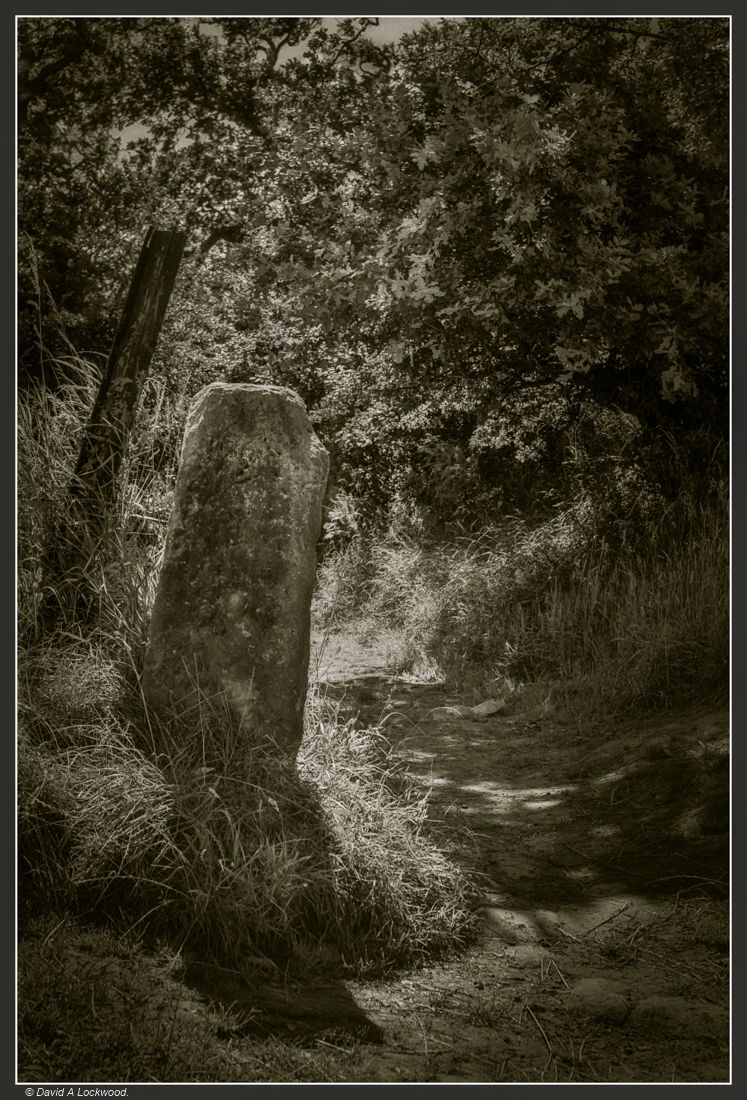 Nikon F4, Nikkor 50mm f1.8 AFD lens on Ilford FP4
Not sure if this is an old Drovers’ way marker or a ‘Standing Stone’ that has been bypassed by the track.
From Wikipedia:
A drovers’ road, drove [road] or droveway is a route for moving livestock on foot from one place to another, such as to market or between summer and winter pasture Many drovers’ roads were ancient routes of unknown age; others are known to date back to medieval times
A Kissing gate.
 This gate (a short cut from where my daughter lives) leads to the Black Horse pub (see thumbnail image below) whose building dates from the 14th century.
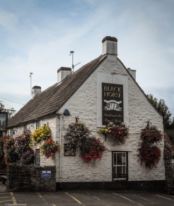 The Black Horse pub – Clapton in Gordano.
Some very nice beer can be had at this pub.
Sun burst.
 A flower from my daughter’s garden, probably gone now the cold weather has returned. Winter is on its way and the clocks go back this weekend in UK.
Changing the time twice a year was first established by the Summer Time Act of 1916, after a campaign by builder William Willett, so that evenings have more daylight and mornings have fewer daylight hours. It’s been changed a couple of times since then, notably during WW II when ‘Double’ summer time was introduced, 1941 to 1945 when Britain was GMT+2. Between 1968 and 1971 the clocks stayed at GMT+1 but statistics showed an increase in traffic accidents during the morning hours but a substantial decrease in the evening so UK reverted back to GMT/BST changes each year. Beginning at one o’clock, Greenwich mean time, in the morning of the last Sunday in March and ending at one o’clock, Greenwich mean time, in the morning of the last Sunday in October.
I hate it, it’s not natural, messes with my body clock, I’ve only just begun to get it into my head that in UK I can’t go shopping late evening, as most shops close after 17:00 hrs.
Pinhole image of a bridge in Bath – Somerset: I think.
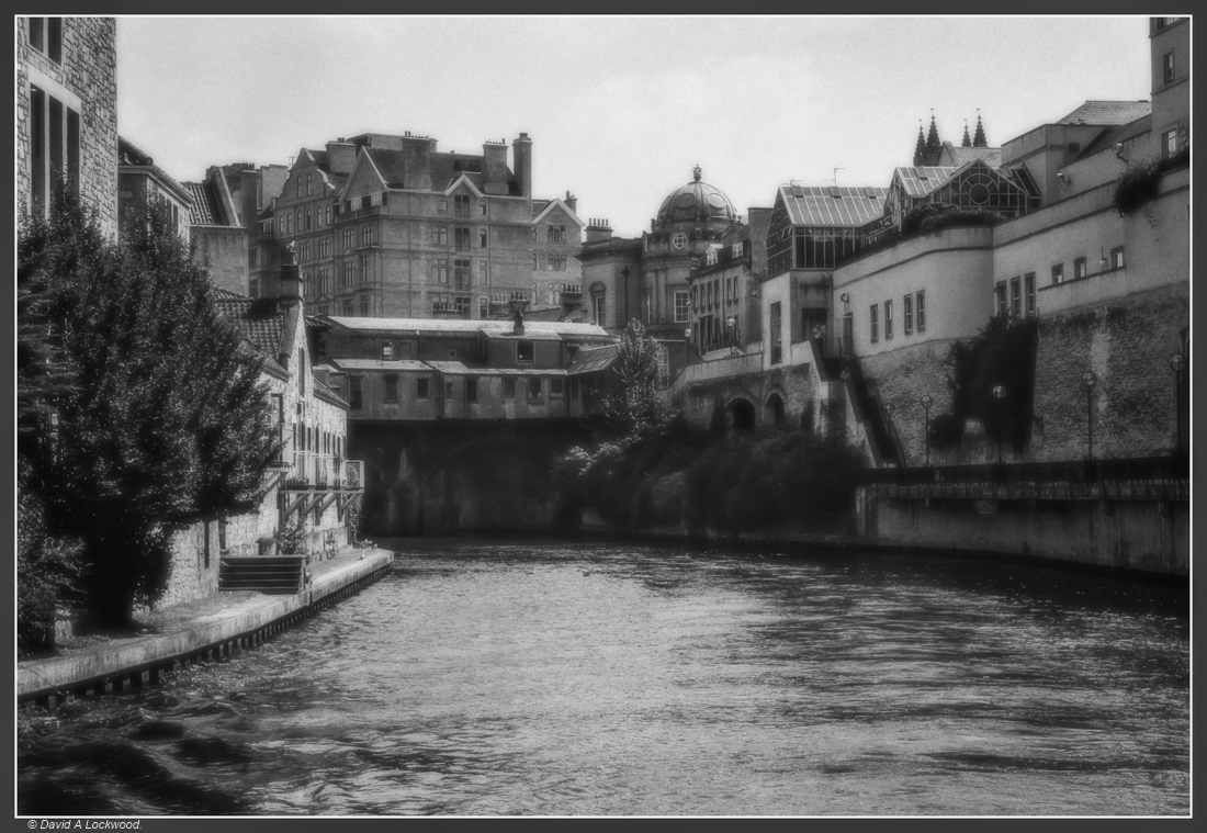 A bridge in Bath – Somerset, I think.
Image scanned then adjusted for noise & contrast in P.S/CS6.
The problem with going through old files and negatives is finding forgotten and unidentifiable images. That is exactly what this is, all the negative page said was ‘Pinhole experiments’ with 35mm camera and body cap, it had several badly exposed and/or very blurred images but this one was the best.
I remember reading about the possibility of using a body cap drilled for a pinhole lens, but cannot find the modified cap since moving.
I do remember using the Nikon F4/Nikon F2Sb after making the lens from a drilled body cap which I then fitted with a disc made from very thin aluminium with a precisely centred hole. The ‘f’ stop was around f:200, calculated by using the following.
f-stop = focal length / aperture diameter
Figures estimated by using a ruler and dividers, was about 0.25 mm and the distance of the pinhole to film plane about 50 mm.
f-stop = 50 mm / 0.25 mm = 200.
For those who wondered what the symbol of a circle bisected by a line was on their SLR, it denotes the point of focus for images at infinity; the film plane.
The disc was sanded, cleaned in Isopropyl alcohol then glued onto the lens cap and all painted with matt black paint.
Why I have never carried on with these experiments I have no idea and the memory jog only came after looking at pinhole images posted on Kevin Allan’s excellent blog filmphotography.blog/2019/09/25/ondu-pinholes-hexham-abbey/ Well worth visiting for his images and articles about cameras, materials & techniques.
Llanthony Priory in the Vale of Ewyas – Wales.
Llanthony Priory in the Vale of Ewyas, within the Black Mountains area of the Brecon Beacons National Park south east Wales.
An Augustinian Priory until the dissolution of the Monasteries by Henry VIII.


As can be seen from the J.M.W Turner picture below, between 1794 & 2019 the site has reduced in size considerably.
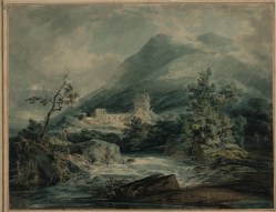 (From Tate Images & Google)
The artist J.M.W Turner’s 1794 painting of Llanthony Priory
In the early 1100s a Norman nobleman, Walter de Lacy, took shelter from a rainstorm in a ruined chapel. Inspired by its remoteness and serenity, he decided to build a church. Others were soon drawn there, finding it a place for solitary prayer, and by 1118 a group of monks from England converted it to Llanthony Priory.
Llanthony’s isolation placed the Priory in a vulnerable position, not helped by the local inhabitants resenting the English monks occupying Welsh land. They repeatedly attacked the building; it was also targeted by thieves, so by 1135 the monks were forced to retreat over the border to Gloucester where they founded Llanthony Secunda. Between 1186 and 1217, again probably around 1325 building work took place allowing the Priory to become fully functional again and on Palm Sunday, April 4, 1327, Edward II visited. Its regained status was not to last, in the early 15th century it was attacked yet again, this time by the Welsh prince Owain Glyndwr as part of his campaign to recapture Welsh land from the English. This started a period of decline and the Priory finally closed in 1538 during the Dissolution of the Monasteries by King Henry VIII.
St Michaels Church Clapton in Gordano Somerset.

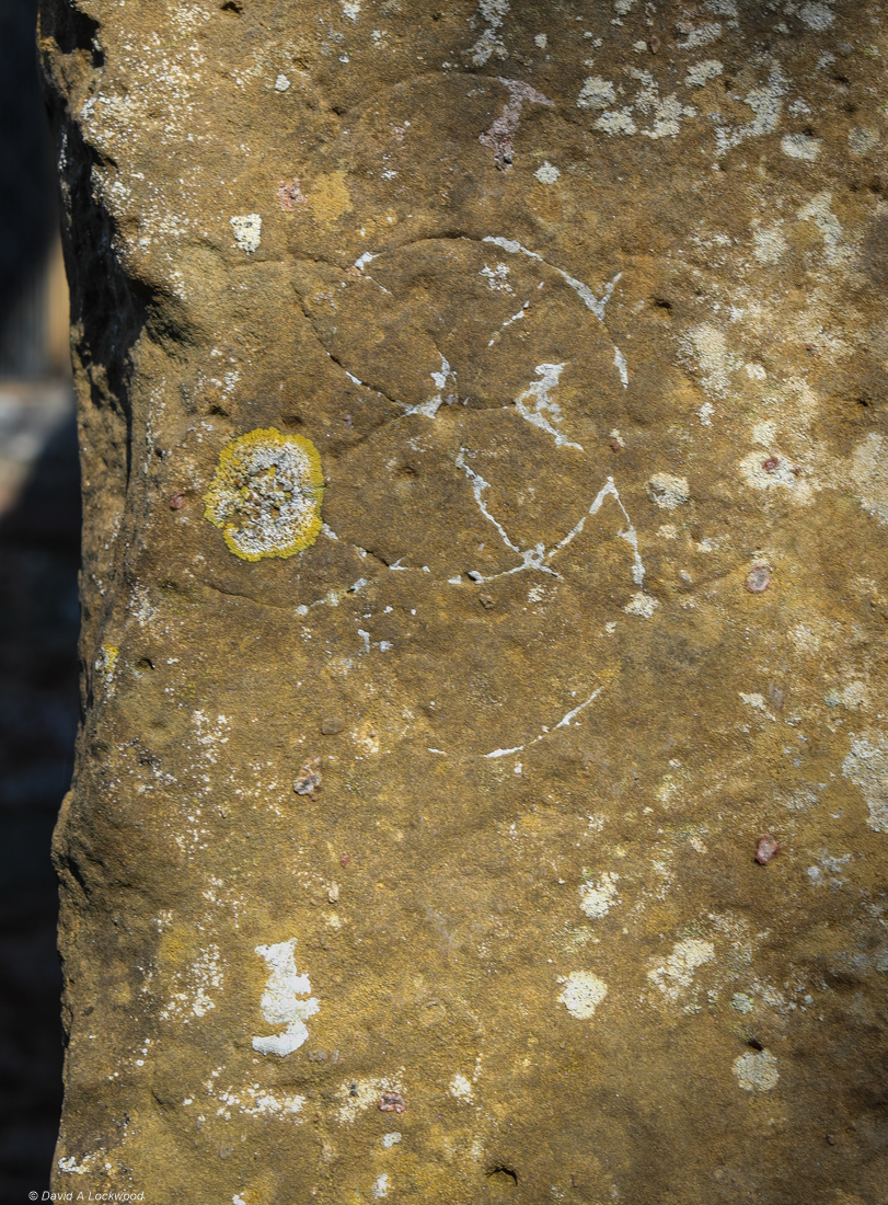
The above image shows an example of Witch markings or hexfoils found on the entrance to St Michaels Church Clapton in Gordano Somerset.
People would scratch specific symbols as an act of devotion or to invoke good luck – these symbols would often take the form of a daisy wheel, or hexfoil, a pattern with endless lines. hopefully to confuse and entrap evil spirits.
Similar patterns can be found on doors in a lot of the abandoned villages I visited in Oman and used for exactly the same reason: they would invoke good luck and well-being for the family or ward off evil or malevolent spirits (Jinn).
Those found in Britain come from a time when a belief in witches and superstition was part of everyday life. People constantly sought protection from evil spirits that might entrap them or cause harm to family or livestock.
They are found in churches, Chapels, cottages along with agricultural buildings and were used from medieval times right upto the 18th century. The oldest so far found in UK (as far as I know) are mid 13th century examples on door frames at Donington le Heath Manor House in Leicestershire.
The Church of St Michael Clapton in Gordano, Somerset, England, dates from the 13th century, although the 12th-century tympanum (semi-circular or triangular decorative wall surface over an entrance, door or window) is the oldest visible part of the church, the majority of the building is from the 13th century.
Unfortunately I was unable to visit the inside, I needed to request a key from the custodians as it is no longer a fully active church; a return visit is a must.
Pump room – Bath.
 From my negative files: Nikon 35Ti on Ilford HP5 plus @ 320asa
The Pump room – Bath: The novelist Jane Austen mentions both Bath and the Pump room in her novels Northanger Abbey and Persuasion.
Known for providing a rather (for me) obnoxious warm mineral water, that has been renowned for its restorative powers since before Roman times.
Whitby – Mid 1970’s No8.


Zenit B with Helios 44 58mm f/2, M42 screw mount lens: Ilford FP4.
All the images so far, came from negatives that I have not looked at for over 40 years. Made with a non-metered Russian made Zenit B using the ‘sunny 16 rule, on Ilford’s FP4 which they introduced in 1968 as a replacement for their FP3; produced from 1942 – 1968. As I did not process my own films in those days, they were taken to local camera shops for development & printing on postcard size paper.
As a matter of interest: The statue of Captain James Cook (1728-1779) can just be seen on the upper right of the first image, his ships ‘Resolution’ and ‘Endeavour’ were built in Whitby.
Omani Dates.
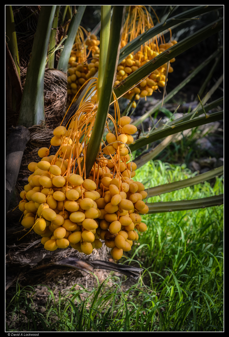 From my Oman files.
Fossil records show the date palm has existed for at least 50 million years.
Dates have been found on a number of neolithic sites, which would suggest that they were being eaten as much as 7,000 to 8,000 years ago.
They provide a range of essential nutrients, and are a good source of dietary potassium. The sugar content of ripe dates is about 80%; the rest consists of protein, fibre, and trace elements that include boron, cobalt, copper, fluorine, magnesium, manganese, selenium, and zinc.
Oman has more than 250 varieties of dates, and each region of the country will tell you theirs are the best. But I think of all, it has to be the ‘Khalas’, found in the Sharqiya and Dhahirah region, also Al Rostaq. The fruit is bright yellow, oval-shaped, and usually eaten fresh or half-dry.
Dates and qahwah arabiyya (coffee) is a fundamental part of Omani hospitality; even the poorest family will offer coffee & dates when one visits.
Another tree in fog.
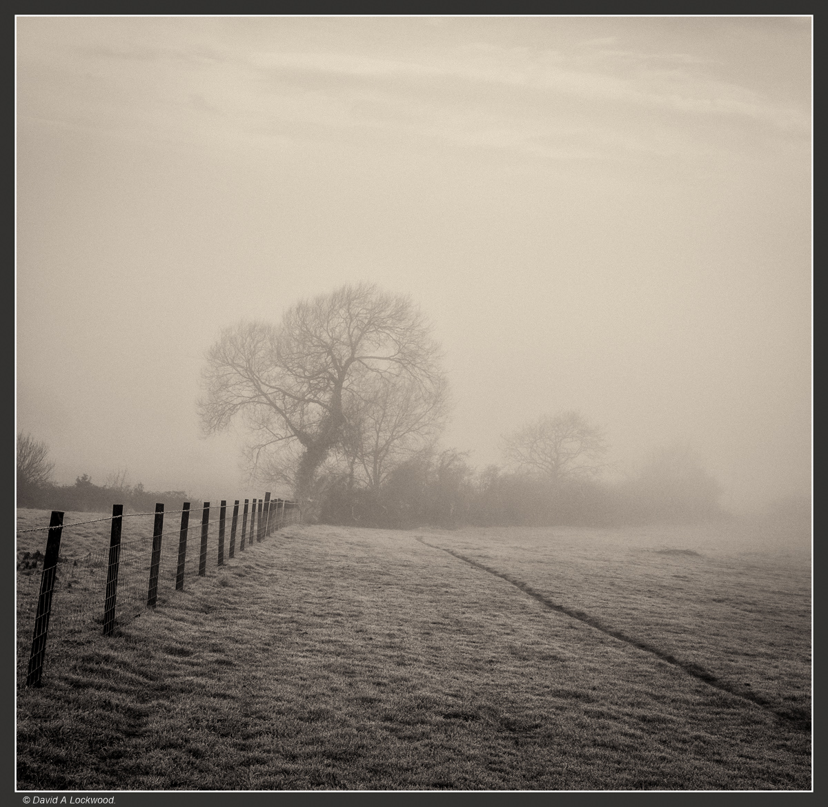 My obsession with trees & fog continues – on this walk I managed to drop a lens cap. Could I find it? not a chance, rather annoying because it was the only thing keeping the front of the lens dry in all the fog. At least it was a cheap item to replace (a free one from my daughter 🙂 ) not like the time I lost my Nikon DK-17M magnifying eyepiece from the Nikon F4, that was rather costly.
If you have never tried one of these, I would recommend getting one, especially if using manual focus lenses; it gives a 1.2x magnification, making the viewfinder appear much larger, without causing problems for the dioptre adjustment.
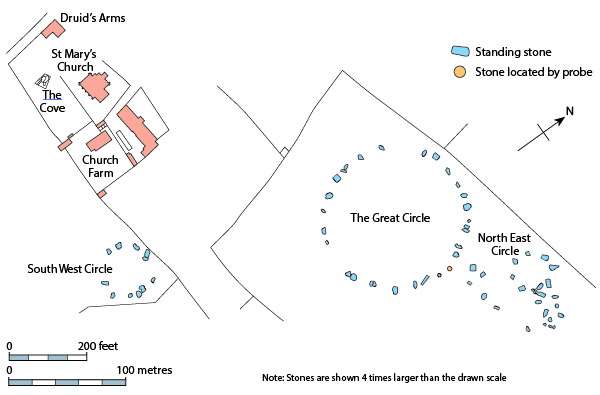
Stanton Drew – Stone circles Somerset No2.
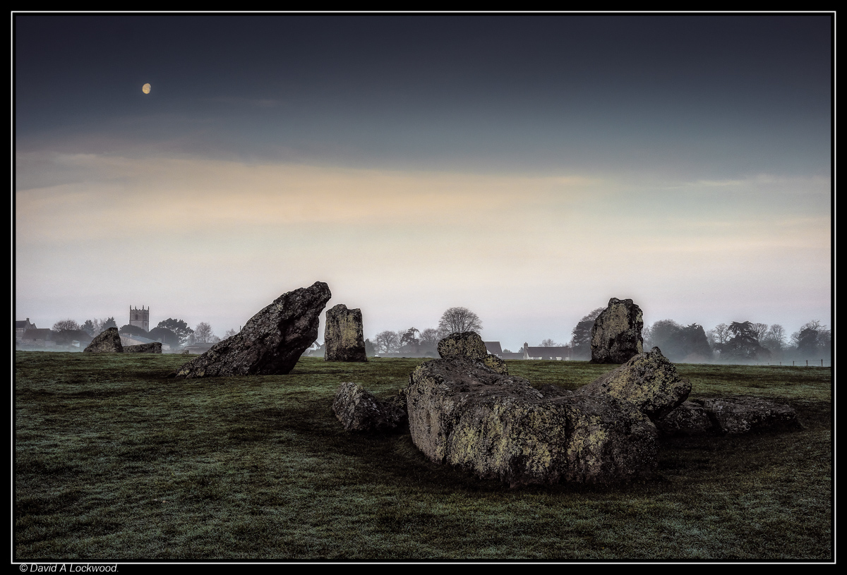 Before sunrise & in the opposite direction from the earlier post I made.
This from wikipedia & English Heritage.
Geophysical work by English Heritage in 1997 revealed a surrounding ditch and nine concentric rings of postholes within the stone circle. More than four hundred pits, 1 metre (3ft 3in) across and at 2.5 metres (8ft 2in) intervals, stood in rings at the site. The ditch is 135 metres (443ft) in diameter and about 7 metres (23ft) wide. A 40 metres (130ft) wide entrance was visible on the north-east side. No surrounding bank has been identified although the site awaits excavation.
The geophysical work transformed the traditional view of Stanton Drew as being a surface monument and the Great Circle is now seen as being one of the largest and most impressive Neolithic monuments to have been built. Analogous with the circles of postholes at sites at Woodhenge, Durrington Walls and The Sanctuary, it is thought that the pits would have held posts which would have either been freestanding or lintelled as they could not have supported a roof at that size. The postholes in nine concentric rings held posts up to 1 metre (3.3ft) in diameter indicating the use of ancient trees which were sacred to the druids.
Nearby and to the north-east is a smaller ring of eight stones in the centre of which the geophysical work identified four further pits. A third ring of twelve stones, measuring 43 metres (141 t) wide, stands to the south-west.
The Cove.
A fluxgate gradiometer survey in July 2009 investigated standing stones in the garden of the Druids Arms public house known as The Cove, which showed that the stones date from nearly a thousand years before the stone circles. The conclusion from the study was that these upright stones are likely to have been the portals or façade of a chambered tomb.
Lone tree – Black Down hills Somerset.
 Black Down, the highest point in the Mendip Hills Somerset.
According to that well-known online Encyclopedia, which agrees with a book I have: the name Black Down comes from the Saxon word ‘Blac’ or ‘Bloec’ meaning bleak or dark and ‘Dun’ meaning down or fort. There are several Bronze Age round barrow earth covered burial tombs & a nearby Iron Age hill fort in the area.
