 Nikon D800 – 50mm f1.8 D lens.
Category: colour.
Misfat Al Abreen Village.
 Nikon D800 50mm f1.8D lens.
Misfat Al Abreen.

 Nikon D800 50mm f1.8 AF D lens.
Misfat Al Abreen is a traditional mountain village perched on the jebel above Al Hamra on the way to Jebel Shams. When I first visited in about 1986, it was very secluded and certainly didn’t get many, if any visitors from outside the local area.
It has now embraced tourism (all be it in a very limited way) as one can stay in a converted traditional village house. I think it was a case of ‘if you can’t beat them then join them’ which helps with the local economy.
There is an abundance of water which allows the growing of bananas, dates, mango, papaya and vegetables in spite of the dry vegetation elsewhere in the summer months.
Sorry: this is beginning to sound like a tourist guide, but it is such a lovely and welcoming village I needed to say more.
A project this winter is to spend time in the visitors house and take pictures……….
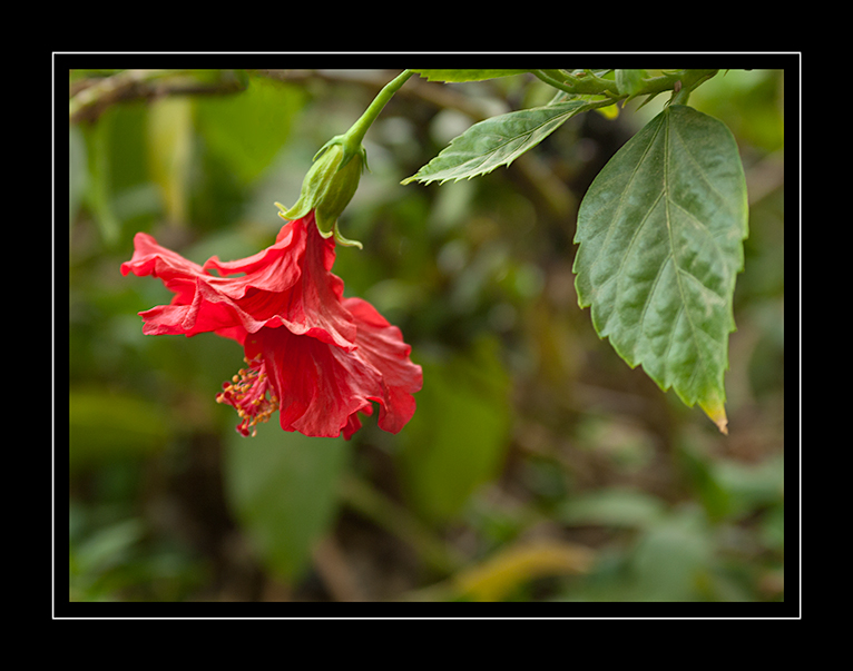
Yellow Hibiscus.
 I thought all my flowers would be gone by now, but no…….
I was passing through Nizwa this morning, there was a slight fog and the temperature was 42c !!!
See this weather link. www.wunderground Nizwa weather
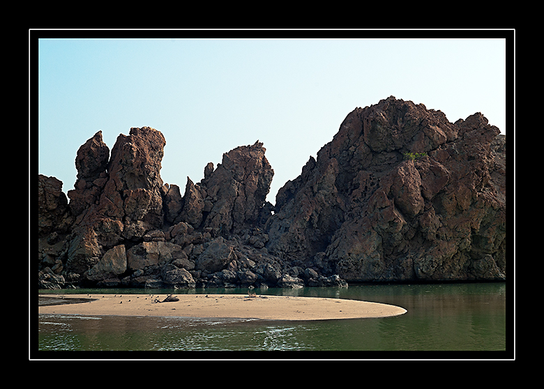
Beach rock formations.

The Hajar Mountains: جبال الحجر
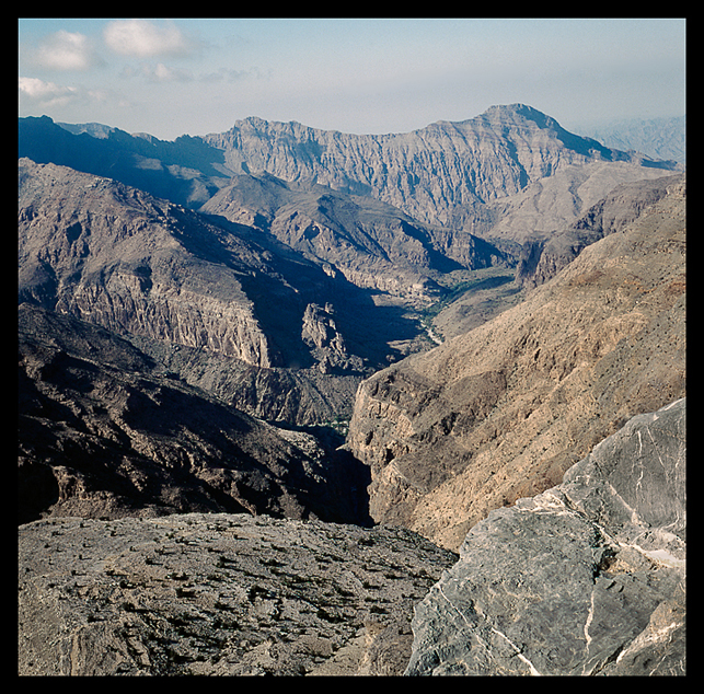 For those interested – this is an indication of the different topography that can be seen when getting up high in the mountains. Made from about 7500ft – note the wadi winding through the valley.
From Wiki:
The Hajar Mountains in north-eastern Oman and also the eastern United Arab Emirates are the highest mountain range in the eastern Arabian Peninsula. They separate the low coastal plain of Oman from the high desert plateau, and lie 50–100 km inland from the Gulf of Oman coast.
The mountains begin in the north, forming the Musandam peninsula. From there, the Northern Hajjar (Hajjar al Gharbi) runs southeast, parallel to the coast but moving gradually further away as it goes.
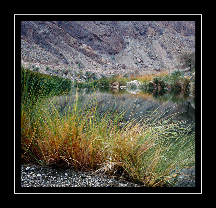
Wild Grass and Water.
 Bronica S2a with Nikkor-P 75mm f2.8 & Fuji 100rvp.
A Deep Pool in the Mountains.
 Bronica S2a – Nikkor 50mm f2.8. Kodak E200sw.
Jebel Fortified House.
 Nikon F4. 50mm f1.8D & Kodak E100vs.
Jabrin Fort.

Nikon F2sb – Tokina 35-70 f2.8 AIS AT-x and Kodak E100vs.
Last of the flowers in my garden.
We are getting into the 40’s now so most of the plants are closing down for the summer heat.
Mountain Wadi.
 Nikon F4 50mm f1.8D – Kodak E100vs.
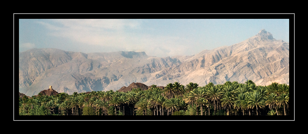
Evening Sun over the palm plantation.
Al Humriyyah (Ruwi)
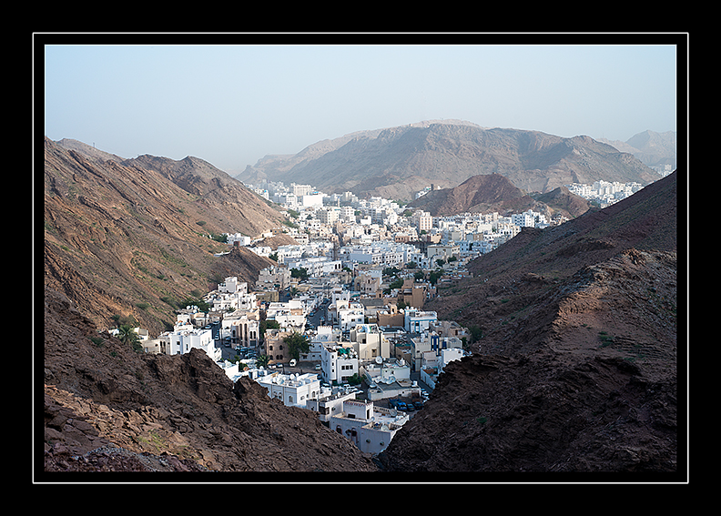 Early morning heat haze burning off – image made from Yiti Street.
On The Beach.
 …….and not a submarine in sight ! 🙂
After the rains – May 2013.

Tree root & Rock detail.
 Nikon D200 plus AF Nikkor 50mm f/1.8 D.
Locust.
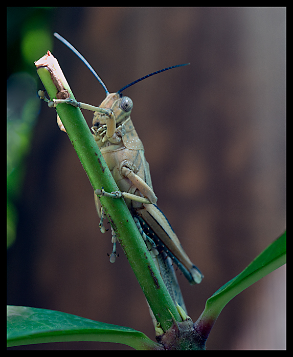
Dreaded Locust – after several days of sometimes quite intense storms, these have appeared ! I hope there are only a few…….
Sorry that the focus is not that good, it was a very quick grab shot (in find camera and run out again, all before it took flight)
Rock Detail No3 – Jebel Shams.

Child in Traditional Dress.
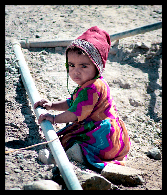
Found this negative in a box of odds & ends.
Must have been made in the late 1980’s or early 90’s because it is on Kodak Gold 100 and I have not used that film for years.
I think it was taken in a village behind Nakhal fort: she did look fed-up!
Rock Detail No2.

Rock Detail.
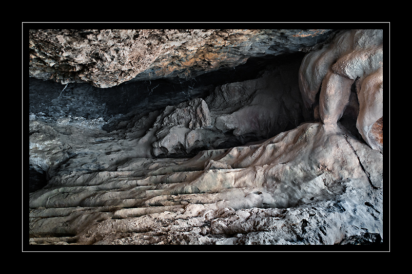
Detail from inside a very deep overhang Jebel Shams.
Nikon D200 (Fill flash) Tokina AT-x 35-70 f2.8 Ais lens.
Rock Art.

An example of what I mean when I said – ‘even with extreme side light the images can be quite faint’
I refuse to chalk them in as has been done by some!
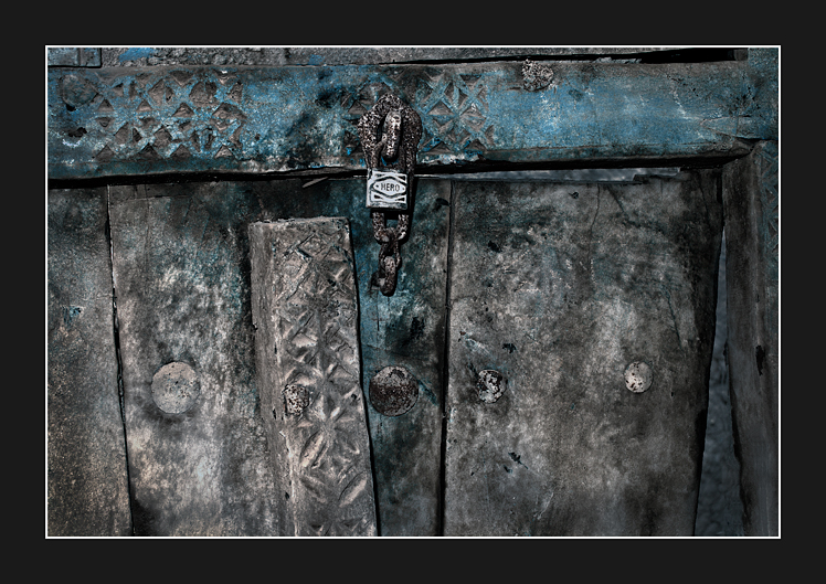
Old Door with Lock.
Muti (Imti).
") Nikon D200 & Tokina 35-70 f2.8 AT-x AIS lens.
Nikon D200 & Tokina 35-70 f2.8 AT-x AIS lens.
