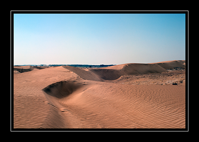
Dawn over the sands.
Dawn over the sands.

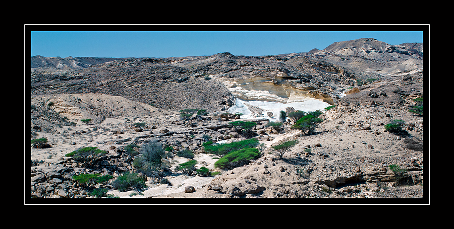
This one was made about 2 kilometres further along the ridge from the image below.
Nikon D200, AF-D Nikkor 20mm f/2.8
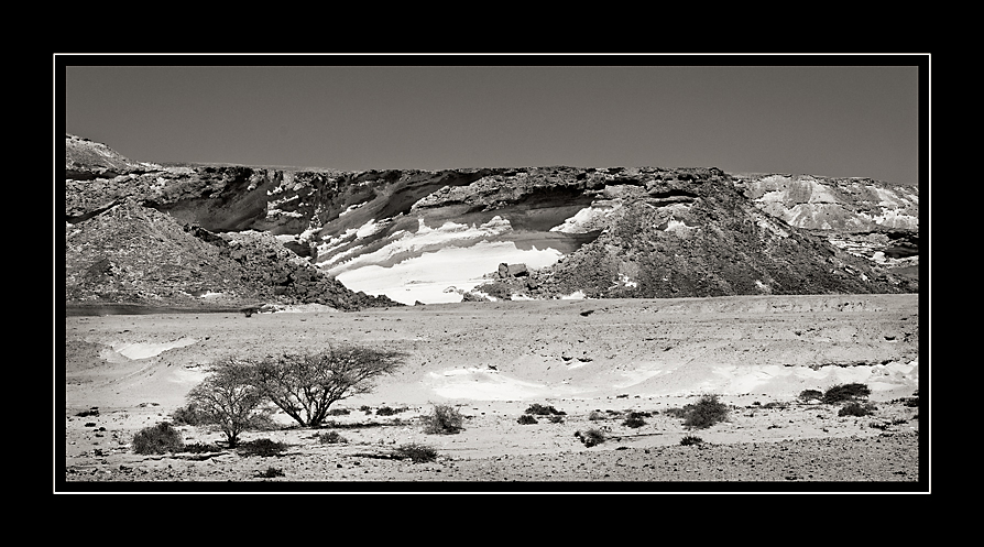
The Huqf.
Nikon D200, AF-D Nikkor 20mm f/2.8 – converted to B & W with CS5 channel mixer.
This lady has the most beautiful voice.

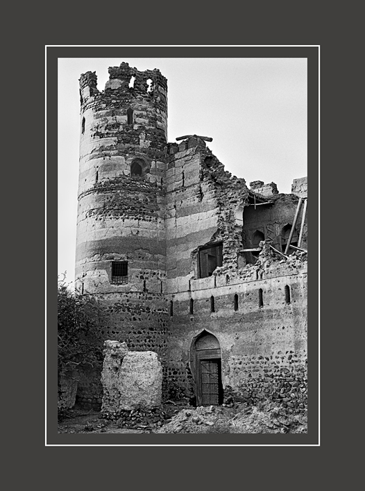
Jabrin Fort: built-in 1670 with tower walls two metres thick.
Kodak TriX in D76 (1+3)
Old style Kodak T-Max 400 in T-Max developer (1+4)
")
Taken with my ‘cheap Nokia phone’ and tinkered with in Photoshop – no camera !
The lost City of Ubar; known by various other names (Wubar, Wabar, Iram of the Pillars and Atlantis of the Sands mentioned by Lawrence of Arabia)
Ubar was a processing and transportation centre for frankincense, an aromatic resin used in religious ceremonies as well as perfumes and medicines, it was as valuable as gold.
Shis’r (Shisr or then again Shasar) being the modern name of this location in Oman. [Even today, names change or most often the spelling used for transliteration can be quite imaginative]
The ancient structure found here from satellite images (Landsat) was partly excavated by Dr. Juris Zarins (Missouri State University) starting in 1992. Others involved were Nicolas Clapp, Sir Ranulph Fiennes, and an archaeologist Dr. Juris Zarins.
There is some considerable doubt !
From that well-known on-line encyclopædia:
When the explorer Freya Stark consulted the works of Arab geographers, she found a wide range of opinions as to the location of Wabar: “Yaqut says: “In Yemen is the qaria of Wabar.” El-Laith, quoted by Yaqut, puts it between the sands of Yabrin and Yemen. Ibn Ishaq… places it between “Sabub (unknown to Yaqut and Hamdani) and the Hadhramaut. Hamdani, a very reliable man, places it between Najran, Hadhramaut, Shihr and Mahra. Yaqut, presumably citing Hamdani, puts it between the boundaries of Shihr and San’a, and then, on the authority of Abu Mundhir between the sands of B.Sa’d (near Yabrin) and Shihr and Mahra. Abu Mundhir puts it between Hadhramaut and Najran.”
“With such evidence,” Stark concluded, “it seems quite possible for Mr Thomas and Mr Philby each to find Wabar in an opposite corner of Arabia.”
See these two links for more detailed information:
 Nikon F2SB with Tokina 35-70 F2.8 AT-x: Tri-x 400 at 320 Developed in Perceptol 1+3.

T-Max 100 in D76 1+1 – Nikon F2SB & 55mm F2.8 Ais Micro.

This type of Bush (Tree) is found all over Oman and has become known as the ba***rd tree by my fellow walkers. It has a nasty habit of jumping out and biting you if one does not pay it due respect: the thorns can be over a centimetre long and very sharp………..!!!


Two things you learn quite early on if you start to do any serious trekking here in Oman.
Find old Ordinance Survey maps, they show most of the original footpaths that have been used for generations. One small caveat, two really; the position of some is only approximate and village names (English transliteration) change.
This is probably the most important: learn to recognise the path, as they can be quite obscure or even lost in the general detritus of previous storms.
In some areas they stand out like a map on the landscape; dark smooth areas on the rock that in many cases has change from rough and sharp-edged rock into glass like smoothness.
When all else fails, children and old people used these paths so if you are finding the path has suddenly become very difficult, you are not on the right route!
Buy this book……. Of all the new publications; it is still the best, even if a little dated now. They put a lot of hard work into getting the routes and maps as exact as possible.
See this link.


 Last major pool before the trek gets a little more difficult.


Fuji Superia 200 (C41) in Rodinal B&W developer: stand developed for 1 hour.

This is a form of Travertine (not being a Geologist I am open to correction) found at the top end of Wadi Ghul.

Another image from a few years back; but this time printed with a slightly more dramatic interpretation.

I have another version from about 3 or 4 years ago in B&W, but reprinted this from a Kodak E6 slide film.
