Al Hazm Fort.

Al Hazm fort entranceEntrance to Al Hazm Fort.  (This one is a bit soft, using manual focus &  the sun very bright: my excuse – need to go back!  😉 )

Al Hazm Castle – according to the Ministry guide-book.
Located in Al Hazm town in the District of Rustaq. It was built by Imam Sultan bin Seif the 2nd in ( 1123 A.H.–1711 A.D.) when he established Al Hazm town as a capital of Oman instead of Rustaq. The Castle is distinctive from other Omani Castle and forts by its magnificent shape and massive building. It contains the tomb of its builder – Imam Sultan bin Seif the 2nd.
The builder Imam Sultan bin Seif was the 5th ruler of the Ya’rruba dynasty of Imams; he was the grandson of the Imam (of the same name) who made the Portuguese an offer they could not refuse! they all left, after many years of attempting to subjugate the people.
This Fort is an outstanding example of Omani Islamic architecture and was built for defence against cannon. The roof is built on columns, and contains no wooden supports. Its walls can withstand the impact of cannon balls due to it being at least 3m thick at any point.
It has the outside appearance of being far larger than it really is, helped by tall walls and two towers, one on the Northwest corner & the other on the Southeast – giving almost 360 degrees of cover.
Another interesting fact; it used an advanced form of vaulted arch which was a major departure from the use of straight lines, along with post & lintel construction as had been seen in most of Oman’s earlier defensive constructions.
There are the usual defensive details such as multiple offset doors, pits just after a door (covered with planks of wood, removed when under attack) murder-holes above doors (think boiling oil or fire) along with hidden escape passages.

I have visited this fort on & off, many times as it not only has some of the most friendly and helpful custodians, but its main feature is the impressive collection of cannon.


Film Enlargers.

Enlarger No1

For a change, I thought I would give some information about the two enlargers I use.

For negatives from 6×9, 6×7, 6×6, 6×4.5 and 24×36:

Meopta magnifax 4:

In comparison with many other enlargers on the market this was one of the best in terms of value for money, quality and especially handling. It may look rather functional but that actually is one of its virtues, it does the job with the minimum of fuss.
It has an interesting addition in the form of ‘split-line’ focusing which actually works very well. Especially for a test print when focusing is not needed at grain level. You just pull out the carrier halfway and see two lines, join them using the focus knob to get one line and everything is sharp. Another good feature is a neutral density filter which is good for reducing the light output, letting one use the optimum ‘ f ‘  stop on the enlarging lens.

It has a choice of three heads, B&W condenser, a Meograde for variable contrast paper and the colour head 3 for all film types, this is the one I use. There are two (more if you include specialist light sources) generally used types of light output, Condenser and Diffuser, I prefer the Diffuser as it uses a ground-glass screen in the light path producing a nice even light across the negative; condenser enlargers achieve this using condenser lenses. There is a debate about how each type produces different contrast levels for a given negative, but I personally have never noticed much difference.

The late Barry Thornton in his book ‘Elements: The Making of Fine Monochrome Prints’ 1993. mentioned that it was one enlarger he never regretted buying for both professional & personal use. As I had enjoyed reading the book and found it informative and entertaining; I looked out for one of these enlargers. Never in almost 20 years has it let me down.
For negatives from 6×6, 6×4.5 and 24×36:

Durst M605:

Although this enlarger was built with the amateur market in mind, the Durst M605 is a strong, precise all metal design, built with the highest standards as was all their equipment.

It accepts negatives up to 6 x 6 cm and although the column is not tall, it is sufficient for making 12×16″ prints. A dedicated extension arm allows one to make 16×20″ prints but this needed to be purchased as a separate item. 😦
The enlarger head is of the diffuser type, the advantage of the diffuser head is the possibility of quickly switching from 35mm to 6×6 by just moving a lever and changing the lens of course. Enlarging lenses are a subject all of their own as the quality varies considerably and the most expensive are not always the best.

The other important feature you need is a glass negative carrier which both have. Don’t be confused by anyone telling you that glassless carriers are easier. Glass carriers require a little more dusting, but they hold negatives much flatter and that produces sharper images, especially with 6×6 or above. Plain glass is good, anti-Newton glass better; it avoids seeing the interference rings (Newton`s rings) produced when two flat optical surfaces are in close proximity, as they create interference effects associated with residual Fresnel reflection.

Both of these enlargers can be found on the used listings and at the moment are quite cheap. That may change in the very near future as more people take up or return to traditional film photography (as is the case with vinyl for example) and they said that was dead as well !

Bats !

Small Bat bahla fortOne of a very large number of small Bats in Bahla Fort.

I don’t think I mentioned Bats from last weekends visit to Bahla Fort  🙂

What with the talk of Jinns and getting a little lost; there  were a great number of bats, especially in the darker corners of the fort. A  feeling of  Transylvania about the place…..

I was determined to get a picture of one, but easier said than done ! So excuse the quality, it is a miracle of Nikon that I got one at all. The body size was about 10cm and the room needed to be dark for them to land, otherwise they were zipping round getting excited about being disturbed.

So how did I manage this image without giving them more stress?

Camera set on Auto exposure, Aperture-priority AE, 1/60 sec, f/8, ISO 200 with built-in flash set very low & using my Tokina 35-70 f2.8 lens. I stood in the room until my eyes adjusted (zone focused my lens) then waited.

Bahla fort.

Bahla Fort

I have been trying to get a visit for aeons, but always closed – beginning to think it was a conspiracy by the jinns that are said to occupy the place….


Bahla fort and settlement owed its prosperity to the Banu Nebhan tribe who had prominence from the 12th to the end of the 15th century and made Bahla their capital. From here they were able to established relationships with other tribal groups of the interior. Bahla was the centre of Ibadism (a branch of Islam), on which the ancient Omani Imamates were based.
The fort became a UNESCO World Heritage Site in 1987. It was included on the List of World Heritage in Danger from 1988 and restoration work began in the 1990s. The fort with its walls and towers of mud brick on stone foundations along with the wall enclosed oasis, is understood to be the third largest example in the world. It’s a labyrinth of floors, doors and rooms; without a guide, needs careful thought as to which way the entrance was, when time for departure. 🙂
The town is well known for its pottery and although not mentioned unless one asks, its magic, in fact its second name is “Madinat Al Sehr”(the City of Magic). All part of Oman’s unwritten history of tradition and folklore.

Cannon found at the entrance.

Cannon no4

Cannon no3

Cannon inscriptionOld !

Necropolis of Bat.

Tombs near Bat No2

This is what UNESCO say about these tombs:

The zone encompassing the settlement and necropolis of Bat is the most complete and best-known site of the 3rd millennium BC. In a restricted, coherent space, the necropolis of Bat bears characteristic and unique witness to the evolution of funeral practices during the first Bronze Age in the Oman peninsula.

Historical sources recount that the country of Magan was the principal extraction centre for copper, which was exported even to far-away Mesopotamia, as early as about 3000 BC. The appearance of a more strictly hierarchical social organization (as attested to both in the settlements, where circular defensive structures contrast with rectangular houses, and in the necropolis, where the arrangement of funerary space is more complex) goes hand in hand with higher living standards and social changes linked to a trade economy.

The protohistoric site extends north of the village and palm grove of Bat, when excavation began in 1972; it includes a settlement and a necropolis from the 3rd millennium BC. In the settlement zone, north of the confluence of a small waterway and Wadi al Hijr, there are five stone ‘towers’, structures that are very representative of the first Bronze Age in the Oman peninsula. One of the towers has been entirely excavated and it has been determined that it was built between 2595 BC and 2465 BC. At the level of the substructures, the plan of the tower features a series of exterior surface projections and two rows of parallel rooms on either side of a large platform in masonry with a well in the centre.

From the tower, which serves as the site’s reference point, can be distinguished immediately to the east on the slope a series of rectangular houses with central courts and, to the north, a vast necropolis that can be divided into two distinct groups. The first group is located at the top of the rocky slope. Its drystone tombs (some of which date from the 4th millennium, although in some cases they may have subsequently been modified) are scattered along the path from Bat to Al Wahrah.

The much more densely concentrated second group extends over rice terraces south-east of the wadi and includes more than 100 drystone ‘beehive’ tombs, which tend to be organized according to an overall plan. The most ancient ones are to the north. They have only one entrance and one funerary chamber and were a collective burial-place for a small number of dead. Towards the south, the sepulchres become more monumental. They have two entrances which open on to two and sometimes four funerary chambers and were intended for larger numbers of dead.

The settlement and necropolis zones of Bat form a coherent and representative group with two neighbouring contemporary archaeological sites: the tower of Al-Khutm, 2 km west of Bat, and the group of beehive tombs of Qubur Juhhal at Al-Ayn, 22 km east-south-east of Bat. The 21 tombs from the 3rd millennium, aligned on a rocky crest that stands out in the superb mountainous landscape of Jebel Misht to the north, are in a remarkable state of preservation. They have not been excavated and constitute an obviously interesting archaeological reserve.

The site can be found near Ibri (عبري‎) a city in the region Az Zahirah, northwest Oman.

A video of Rock Art research in Saudi Arabia.

The YouTube video below is rather long but if anyone has an interest in the subject, it is well worth watching. I have also included a link to the site that is mentioned in the video: for those that maybe missed my last mention of it, please look as it is one of the best and most informative sites I have ever seen.

Another point worth mentioning is: why would I include a topic that refers to Saudi Arabian rock art when I am in Oman?

Because they have come to realise its importance and that it is very much part of the regions cultural heritage.  Not to mention that from an educational point of view, they are willing to spend money promoting the subject and most importantly, make it easily available for anyone to see for free. Oman seems to make it an academic subject and so information is not widely published  outside learned journals – one needs to search for it.


here is the link to the site mentioned: http://saudi-archaeology.com/overview/team/

Rustaq Fort.

Rustaq fortNikon D800 – AF-S Nikkor 35mm f1.4G.

(As usual – where do I find a straight line!)

Another early morning impromptu trip.

Rustaq: once the capital of Oman, during the era of Imam Nasir bin Murshid al Ya’arubi. (The one that suggested in 1620 that the Portuguese should leave Oman – he gave them an offer they could not refuse!  by 1650 they were all gone and if the Omanis had their way; never to be seen again)

Rustaq Fort: originally known as Qalat Al Kisra was constructed in the 13th century. Recently refurbished, like many of the more significant forts in Oman.

It has a wall around the inner castle (similar to ‘Norman’ construction in the UK)  A falaj runs through the fort to supply water for the inhabitants. Should this become contaminated, they were able to rely on a well, giving them the ability to withstand a long siege. One feature of Rustaq Fort is its four watchtowers: Al Burj Al Ahmar (The Red Tower); Al Burj Al Hadeeth (The Modern Tower); Al Burj Al Reeh (The Wind Tower); and Al Burj Ashiateen (or The Devil’s Tower).

 More images to follow 🙂

New Computer – yet another up-date: Office 2003.

For the want of sending people to sleep………..   😥

I have just about finished making all the changes to my new computer and ……….  as I have a fully paid copy of Windows Office 2003 (note that date) thought I would ignore what received wisdom says 🙂

I loaded it and would you believe that even when I got the odd  ‘computer says no’ which I dutifully ignored; as one does with Windows. Lo & behold it works !

Caveat: Outlook and word have been tested, they being the bits I really wanted and so far no problems (in fact I now have my Pop mail account working and that, says Microsoft was not possible with Win 8) pushing cloud 365 me thinks.

I was able to go to Microsoft site and download ‘Office S.Pack 3’  and load it from the file – no problems.

So by my reckoning any Office from the above date should in most cases work – well for us mere mortals that is (those who need all its abilities may (I say may) have problems) but for me; I am a happy bunny.

New Samsung computer.

Just a little up-date on my new Samsung computer (great by the way & only let down by Windows 8) which for all intents & purposes has gone ……!

I now no longer need to see that stupid ‘tiles’ page, not to mention ‘charms’, all gone and boots-up straight into a computer that looks like Windows 7 but faster  🙂

Downside is that I never could get the screen calibration software to work satisfactorily; not a big loss as it was 8 years old and Xmas is near enough…. I just hate being wasteful.

How did I do all this: lots of reading on the internet from other dissatisfied users (and there are lots) Vista comes to mind.

Animated musical notation.

One of the advantages of the internet:
I sometimes like to listen to music while following the score, made much easier now that these can be down loaded for free in most cases.
But when first doing this, it can be a little daunting (apart from needing to be able to read music that is 🙂 ) so I concentrate on one instrument and then progress.
But I have found a series of videos on YouTube by someone called ‘smarlin’ & others that uses an animated score – basically it reproduces each instrument with a coloured line and the duration of the line is the note being played. The colour represents the instrument or in the case of, for example the piano, the finger being used.
I have found these a great help when first following a new score, it is almost like a visual representation of what goes on in the brain (mine anyway) when trying to combine all the instruments.
There are some that show the bowing movement for solo stringed instruments (everyone goes in the same direction with the bow David !….. 12 and the knuckles on my right hand got sore from being tapped).
Example : If you want to follow Bach, Toccata and Fugue in D minor, the above shows the complexity in a very clear and understandable manner.

Just in case anyone is interested 🙂

Archaeological structures: Saudi Arabia.

Just been having a stroll around Saudi Arabia   Google Earth …….
Found this: Enlarge the image using the link ‘view larger map’ and zoom into the green arrow.
looks very interesting and seems to have only recently come to the attention of Aerial Archaeologists  due Google Earth enhancing the resolution of the area.
I cannot as yet find much about them, other than they have been known about since the 1920 when Royal Airforce pilots mention unusual archaeological structures: I knew I should have got out more when I was there in the early 80′s.

Update:
If the above has got your interest, have a look at this link for:  saudiaramcoworld desktop.archeology for more information that has just been sent for me to peruse.

South America does not have a monopoly on this stuff – fascinating.

Ramlat al-Wahiba.

Sand Dunes B&W No 6This area is about 12,500 square kilometres (4,800 sq mi).

N.B……. If all the right precautions are taken (if you don’t then it is the survival of the fittest and you deserve to die) because there is not much chance of a rescue and the Bedouin will just think you an idiot!

An area well worth a visit for those wishing to experience the vast stillness of the desert. Unpolluted (unpopulated 🙂 ) fantastic clear night sky, which allows a view of the stars in all their glory ‘without the usual light pollution’ and a stillness which is almost palpable.

From that well-known on-line encyclopaedia:-

This desert was formed during the Quaternary period as a result of the forces of south-west blowing monsoon and the northern shamal trade wind, coming in from the east. Based on the types of dunes found in the area, it is divided into the high, or upper, Wahiba and low Wahiba. The upper area contains mega-ridge sand systems on a north-south line that are believed to have been formed by monsoon. The dunes of the north, formed at some point after the last regional glaciation, measure up to 100 meters (330 ft) high, with peaks accumulating in the areas just beyond the strongest wind speeds, where declining velocity wind deposited sand. The north and west boundaries of the desert are delineated by the fluvial systems Wadi Batha and Wadi Andam.

Beneath the surface sands are an older layer of cemented carbonate sand. Alluvium deposits believed to have originated from the Wadi Batha during the Palaeolithic era have been disclosed in the central desert 200 meters (660 ft) beneath the inter-dune surface. Wind erosion is believed to have contributed to the existence of a nearly level plain in the south-west.

Normality is resuming – I think.


“We are now cruising at a level of two to the power of twenty-five thousand to one against and falling, and we will be restoring normality just as soon as we are sure what is normal anyway.”
Douglas Adams, The Hitchhiker’s Guide to the Galaxy

In the meantime:-

Tombs near Bat

Burial Tombs near Bat: the white one is how they would have looked when in use. It was reconstructed by archaeologists to give an idea of the impressive visual image created, when first seeing them on the surrounding hills.

The Ibri region is very rich in necropolis and archaeological sites dating back to around the third millennium. The village of Bat about 30 kms east of Ibri, appears to have been occupied continuously for well over 4000 years. This type of tomb does not seem to have been collectively used but rather, contained between two to five distinct burial sections.


Innerdale Monument Masirah.

Innerdale MonumentInnerdale Monument.

From an account by Tommy Hazell  Saltford, Bristol.

In 1943 a group of airmen built the monument on the North-East tip of Masirah near the airfield. It commemorates the massacre of the captain and 21 crew of S.S. Innerdale, a vessel of 3,340 tons, that had run aground on the Kuria Murile islands on 2nd August, 1904. The party left their lifeboat seeking help, and probably thought they had landed on the mainland. A tragic misunderstanding with the natives resulted in the deaths of captain and crew. The ship’s boy was the only survivor. The ringleaders were later executed by the Sultan of Muscat’s forces. The inscription on the monument was misspelt “Inverdale”, and seems to add a unique touch to an unusual piece of history.

A more official account:

The only survivor was a cabin boy who was taken aboard the Dalhousie. Whether the captain had deliberately decided to land, or had simply been driven ashore by the monsoon will never be known, but it appears that on landing, the crew were met by the local sheikh. The Arabs were friendly at first, but at some stage in the proceedings one of the crew fired a pistol. Whether the crew feared for their safety in some way or there was simply an accident cannot be ascertained, but in the resultant fight twenty-one of the seamen were killed. The Arabs buried the bodies in the sand near Ra’s Qudifah, close to the Northern most point of the island. The ringleaders were later captured and punished; some received the death penalty and were also buried on the Northern tip of the island

Today’s impromptu trip…… Halban.

Tombs at Halban: an impromptu trip that I took this morning (early 06:30 ish) well that’s early for me 🙂

 Halban is about 40 mins. drive from where I live, I was awake (don’t know why – especially on a day off ! ) so thought I would beat the heat of the day.

 Halban Tombs 2

Halban Tombs

Halban Tombs 3

Halban Tombs 4

Halban Tombs 6

Halban Tombs 7

Halban 2

Halban

A little about the tombs at Halban.

The small tombs (there are lots!) found in Oman are generally assumed to date from around the Hafit Period of (3200-2600 BC). They originally had a similar appearance to a beehive, enclosing a small chamber for burial.

Archaeologists believe that the larger tombs found at such sites as Halban, date from the Umm al Nar period in the Bronze age, circ;  2700-2000 BC.. The Umm  An-Nar Culture is one of the most important periods in neighbouring UAE, notably Bahrain.

See this link for more:

.abudhabi.ae/egovPoolPortal 

From archaeological evidence it is suggested that trade in copper with Mesopotamia and the Indus Valley gave rise to the wealthy land known as Dilmun, thought to be in Bahrain. Obtaining copper from the Land of Magan, now largely identified with the ancient copper mining areas in Oman and the adjoining area of UAE. The presence of copper ore in the hills near Halban again points to the link with copper and an Umm Al Nar period.

During the early 1950s, Danish archaeologists excavating grave mounds in Bahrain, found 4,000-year-old settlements and temples thought to be Dilmun, known as the city of the gods in ancient Sumerian literature. Their 1959 discovery on the island of Umm an-Nar near Abu Dhabi of another, previously unknown culture contemporary with Dilmun was unexpected. At this site an outer wall enclosed circular graves, between 15 & 40 feet in diameter with a tower like appearance; in which as many as 25 to 30 people could be buried.

Encouraged by the discoveries at Dilmun and Umm an-Nar; Danish archaeologists excavated 200 single-chambered burial cairns near Jebel Hafit on the Oman-United Arab Emirates border. Here they discovered a culture earlier than both Dilmun and Umm an-Nar. Excavations yielded jars with geometric designs painted in black, white, and dark red, copper and bronze pins along with stone beads. The jars were the same type as used in southern Mesopotamia around 3000 B.C. One problem though; unfortunately there seems to be little trace of the ancient settlements that should accompany these tombs.

The Umm al-Nar tombs are circular and their outer walls were faced with well-shaped smooth stones in a spiral construction. Internally they were mostly divided into a number of chambers, these being used for collective burial. Probably by a family group or members of the same community; who would use them for several generations.  In some, archaeologists found the remains of more than 100 people buried in one tomb.

In Oman these tombs have only recently been ‘investigated’ by the outside world (1991 or there about) although when one asks the locals, they will tell you they have always been there and if lucky, will follow this up with “would you like to see some more”………

Obtained from the Web and various publications I have; therefore any errors in the above are down to me………

More links:

uae.com/timeline.html

New Portfolio Archive.

I am in the process of up-dating my archive images (long over due ) the first is now done:

Portfolio Archive for 2013 No1.

Far better presentation than the old ones – maybe I know a little bit more about what I am doing than before….. 🙂

I have also been using L/R for jpg export, with a copyright notice; all very easy when! I take the trouble to actually look how it’s done. Unfortunately, computers are not one of my favourite items. Many a time it has almost gone out of the window due sheer frustration.

Thinking and process behind ‘New interpretation of an old negative’

I thought it may be of interest to some, if I explained my thinking and process behind this image.

Trees-toned

It all came down to the light meter I used and the fact that I had only come equipped with Ilford HP5 plus, although in this case, that film being an old style emulsion, helped when developing.

Reflected light meters – the type found in every camera, measures the light reflecting off the subject. There are also hand-held reflected light meters like the type I use (Pentax Spot & Weston Euromaster) see this link for the Weston, almost a work of art: WestonMaster

Pentax-&-Weston-Meters

The Pentax is now unfortunately, no longer made and the second-hand price is a bit silly.

Spot meters measure the light reflecting off a very small part of the scene and in the case of the Pentax it’s 10.

Because dark objects reflect less light than bright ones a reflected light meter can be fooled by an unusual subject or background. With the spot meter this can be avoided by it having the ability to select a very precise point in the image.

This is also where the Zone system comes in to play, as one can then decide exactly where to put that point on the scale I to 10  (10 being paper white and 1 being max black)

The Weston just takes an average reading and so is nowhere near as accurate as the sophisticated metering of today’s cameras. I only use the Weston for incidental readings.

Incident light meters measure the light falling on the subject so is not influenced by the subject’s reflectance. Many hand-held meters can measure both reflected and incident light and are identified by a white translucent dome which can be fitted over the light sensor.

This type of meter is used to get the most accurate readings possible to determine a successful exposure. In particular, hand-held meters are valuable in more difficult light areas, including situations that involve a great deal of difference between the light on the subject and that of the entire scene.

Incident meters give the photographer much more control over the light measured and then being able to deciding what exposure is best for that particular subject. The purpose of an incident meter is to measure only the amount of light falling on the subject, they are designed to minimise the influence of background light. Thus, whether the subject is close or far, the exposure of that subject will be equal in all situations, providing a more natural and consistent colour, contrast, and depth.

By measuring all the light in the field to determine brightness, incident meters are able to adjust for wide contrasts in the scene. The image produced using this method will be a much more precise representation of the subject’s appearance.

The only major drawback to incident metering is that it requires the photographer to gather measurements in a most precise way; the incident meter reading must be taken in the same light that the subject is in. That means that the meter must be facing the camera so that it sees the light falling on the subject, not that which is reflected from the subject. That my friend is where the reflective meter comes in to its own.

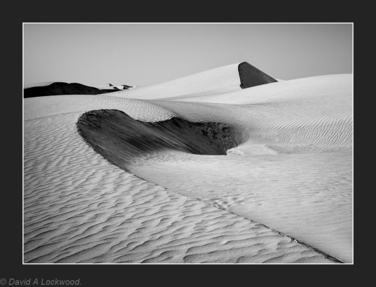
Reflective meters as found in all cameras, measure the light in the field of view as reflected from the subject. Using this measurement to create an average value, these meters provide a recommendation for the correct exposure of that image. But in the case of my image, that was never going to work as the range of light exceed the ability of the film to capture it; I also needed some of the subject to be ‘just down from paper white’ not grey which is why I used a combination of both metering methods.

They are most effective when used in ordinary lighting situations, where the subject does not stand out from the general scene in terms of light values. This is because reflective meters do not have the capability to compensate fully for very light or dark subjects in the same scene. Snow for example will become a dull grey because the meter has not been able to accommodate the extreme reflectance and so has set it to an average value; modern cameras are very much better at dealing with subjects like this but, remember those blocked-up high lights 🙂   (A correction: this should read ‘blown highlights’ me getting negative terminology mixed with digital were the negative would be totally black giving paper white the exact opposite with digital – thanks DH)

All the above is only the start of getting a good image printed and displayed on your wall and with luck, someone else’s……..

Developing the film or using ‘Lightroom’ along with the chosen paper, all play a part in the process and I may just get around to that in another post.

Some may have noticed the grey scale attached to my Pentax meter’s exposure dial, it is an addition that helps me determine what adjustments to make when using the zone system.  More details on both can be found by reading this book: see link here:  Way Beyond Monochrome

Now for the reason why I have been stepping outside my comfort zone.

The posting of ‘New interpretation of an old negative’ gave me a lot of trouble both when taking the image, and more to the point when scanning for this blog.

I was out camping in the mountains and as is my want, decided to stay overnight near where this was taken, precisely because I thought I could make this photograph in the early morning light. But, no infra-red film…….

With good exposure control (I hope 🙂 ) and a compensating developer (more on that another time) I thought I would be able to capture the glow of the light in among the trees. Printed on Matt FB paper and toned, I was very pleased with the result. But my scanner and more to the point my skill using it, gave me grief because of the limitations inherent with B&W negatives and the way the scanner works. So unfortunately what you see is not the best representation of this photograph, but near enough for government work as they say.

New interpretation of an old negative.

Trees-tonedNew interpretation of an old negative previously posted.

I have been working on a re-print of this negative. One of the advantages of scanning negatives is the ability to play around with them before printing in the darkroom.

Previously it would take several prints and sometimes many hours working up to a final print. Now, if I have an idea about a negative, I can scan and play in Photoshop, I then make notes and go for it in the darkroom, without wasting paper (that paper now being VERY expensive compared to only a few years ago)

Pre-visualisation is not always the final interpretation: look at the number of changes Ansel Adams made to Moonrise Hernandez New Mexico.

He is still one of the major contributors to B&W photography, even if he has joined the ranks of those that seem to be denigrated by some these days.

His Zone System is about the only way to get good exposure in difficult light; especially combined with a spot-meter. If you don’t believe me then remember all those blocked-up high lights (err ‘blown highlights’ in the digital world 🙂 ) that cannot be controlled in Photoshop. Yes, sometimes it is unavoidable, but in most cases they can be controlled at the point when the image is made.

The above image is not made on IR (Infra-red film) it’s Ilford HP5 @ 320 in Microdol-X @ 1+3.

Another Door.

Decorated-doorNikon F2sb. Tokina AIs 35-70  AT-X f2.8 Tri-x @ 400 in D76 1+1.

Another one of those images that I could not find a straight area that looked good – so gave up and used the steps and no I do not have a ’tilt & shift’ lens.


I did a print of this negative back in about 2010; but recently I have been working on a new print that has been ‘painstakingly re-touched’ with spotone retouching dyes.

I never liked the mains cable down the left-hand side of the door on the original and  think the owners would have been a little miffed if I’d removed it  🙂            This could have easily been accomplished with Photoshop but……… back in the days when there was no such thing, the only way to remove distractions from an image was using retouching inks.

The technique was very simple in theory; mix the ink to the required colour and with a small artists brush, apply to the print using only the very tip of the brush, dotting the dye onto the paper.

But theory is great until one puts it into practise; it requires a good sable hair brush (the best for holding liquids and obtaining a very fine point) an almost dry brush and lots of patience!!!

If done correctly it is almost indistinguishable from the surrounding area of the print; not possible with colour prints I might add. Ilford Matt or semi-matt fiber papers are my medium of choice because they absorb the ink rather than it sit on the surface. These dyes came in sets of six pre-mixed colours which used together gave an infinite range of shades. Unfortunately (that word again) they are no longer available but, Ansel Adams in his book ‘The Print’ mentions Edward Weston used an India ink and gum arabic mixture. I have modified this slightly by using the Japanese ink blocks which are available in a variety of colours, mixed with gum Arabic and distilled water; it works very well. So when my inks run out I will use this method instead.

Now all this may be an anathema to the purists among you but, I am not making ‘documentary’ images.

Husn Al Heem (Nakhal Fort)

Nakhal-Castle-Toned

Husn Al Heem (Nakhal Fort)

Nikon F4 & Micro-Nikkor f 4 AI  200 mm lens (That is not a misprint, it functions very well as a telephoto lens as well as a macro)   T-max 400 @ 320 in T-max developer 1+4.

Husn Al Heem (Nakhal Fort) The origins of which probably date to pre-Islamic times, the structure being continuously remodelled over the centuries; this included a substantial rebuild in the mid-seventeenth century. The present gateway and towers were apparently added about 1834 during the reign of imam Said bin Sultan.

 It would seem debatable when Nakhal (or Nakhl ) had its first fort at this location, but there is growing evidence that there has been some sort of fortified structure on the rocky outcrop for a very long time. So it is not inconceivable that it was strengthened or remodelled during the Ya’aruba Dynasty.

The Ya’aruba Dynasty (1624 – 1744): Ya’aruba Imams introduced a period of renaissance in Oman’s fortunes both at home and abroad, by uniting the country and bringing it a great deal of prosperity. It was under the Ya’aruba dynasty that many of the imposing castles in Oman were built.

This is what some of the fort looked like before the substantial refurbishment was started in about 1990.

Nakhl-Fort-(Al-Batinah)The above is made from a similar position to the one in the previous post – Traditional Omani Fort.

Nakhl Fort (Al-Batinah)Unfortunately this has a slight colour cast in the sky: this is an old Kodak C41 negative processed by a local shop as I did not have the means to do it my self in those days.  could probably remove in Photoshop but hay-ho……..

I am not sure why there is this desire for what is substantially a rebuild;  even if all the materials and building practises follow the old traditional ways. but it does generate a lot of interest from visitors so maybe it is just me.

I tend to think castles should be stabilised and left as they are, such as is the case in the UK with the ones mostly built by that ‘Jumped-up Norman’

Explore the rock art of Saudi Arabia: Web Site.

A Saudi Arabia Rock Art information site that I have just been given:

saudi-archaeology.com

This is an amazingly detailed and informative web-site for anyone interested in rock art and a must see.

Their introduction page says it all.

This Web site is designed to give scientists and the public an opportunity to explore rock art in the remote landscape of Saudi Arabia. Take a tour and learn about the ancient people who carved the petroglyphs and the animals they hunted and herded. We have chosen some exciting imaging techniques to best depict this dramatic art. Some of our Web pages are interactive, allowing you to zoom in on specific figures or navigate around an image (GigaPans), or change the lighting on an image to see more (PTMs).

If you look then I hope you have an hour or two spare…. 🙂